 A Place Called YORKSHIP - The Map
A Place Called YORKSHIP - The Map
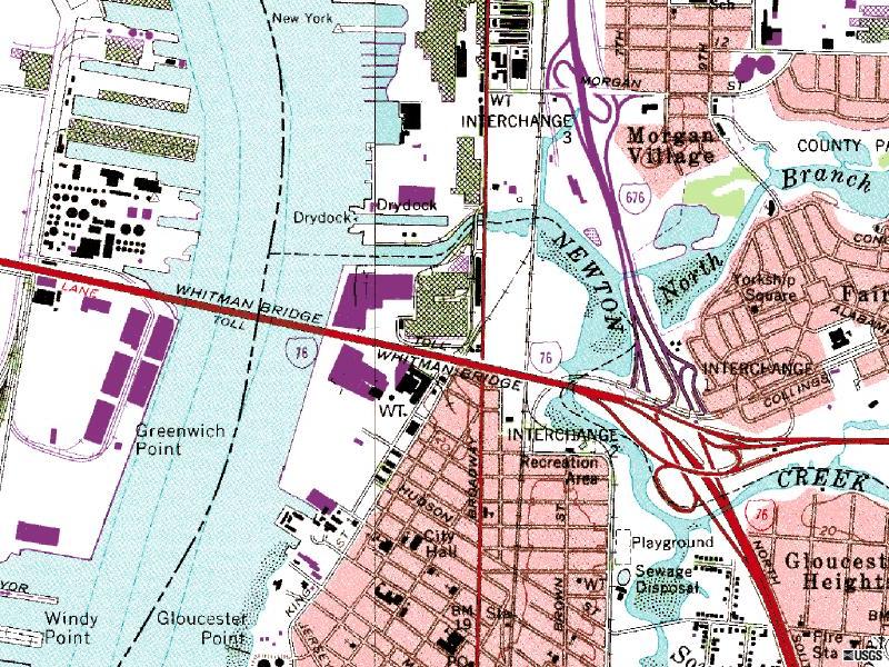 New York Shipuilding Company was
established on the east bank of the Delaware River, to the north
of Newton Creek. It grew southward until it straddled the creek.
New York Shipuilding Company was
established on the east bank of the Delaware River, to the north
of Newton Creek. It grew southward until it straddled the creek.
Contemporary maps still show (north to south) the wet basin, the remains of the large shipways, and the Kitty Hawk drydock..Construction of the Walt Whitman Bridge carrying I-76 (originally I-680) between Philadelphia and Camden began in 1953, and the bridge was opened to traffic May 16, 1957. The course of Newton Creek was altered for construction of the east approaches and the I-676 interchange, which rests on fill atop the original tidal floodplain of the creek's main channel. That area was formerly crossed by a long causeway bridge linking Fairview and Gloucester.
![]() to Yorkship Main Page
to Yorkship Main Page
![]() your
Yorkship memories to Michael
Kube-McDowell, Class of '68
your
Yorkship memories to Michael
Kube-McDowell, Class of '68